For thousands of years before the arrival of Europeans in the 17th century, the native tribes of present-day southwestern United States thrived in this challenging climate among endless red and orange canyons, snow-capped mountains, stone spirals, mesas and buttes, giant rivers and lakes, majestic animals and birds and powerful rivers that have carved the landscape for millions of years.
In addition to building sophisticated ancient sites such as cliff dwellings and kivas that once housed thousands of people hundreds of years ago, early inhabitants of the region also left thousands of carvings (petroglyphs) and paintings (pictographs) on rock faces throughout the southwest.
The American Southwest is home to some of the most intriguing petroglyph sites, where ancient cultures etched their stories, beliefs, and experiences onto rock surfaces.
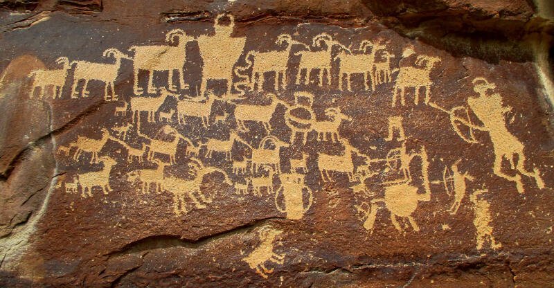
This centuries-old rock art scene at Nine-Mile Canyon is referred to as ‘The Hunting Scene’
These petroglyphs offer a glimpse into the lives and spiritual practices of the peoples who once inhabited these lands.
While most of the petroglyphs that have been discovered and publicized depict historical scenes of hunting wild animals and of conflicts with other tribes, there are other petroglyphs that have baffled and amazed scientists and explorers since the beginning of the Europeans arrival in America.
One of the things that is amazing about the difference of petroglyphs, compared to pictographs, is how many of the most prominent and vivid utilize the dark black ‘desert varnish’ canvas to carve into. Desert varnish is a natural phenomenon found throughout certain desert regions of the southwest.
This black ‘desert varnish’ is a glossy, sticky coating that forms in arid environments. It is formed as a composition of wind-blown clay minerals, iron oxides, manganese, and other particles that accumulate over time through bacteria chemical processes.
- Lake Winnemucca Petroglyphs
- Coso Range Petroglyphs
- Nine-Mile Canyon Petroglyphs
- Newspaper Rock Petroglyphs
- Valley of Fire Petroglyphs
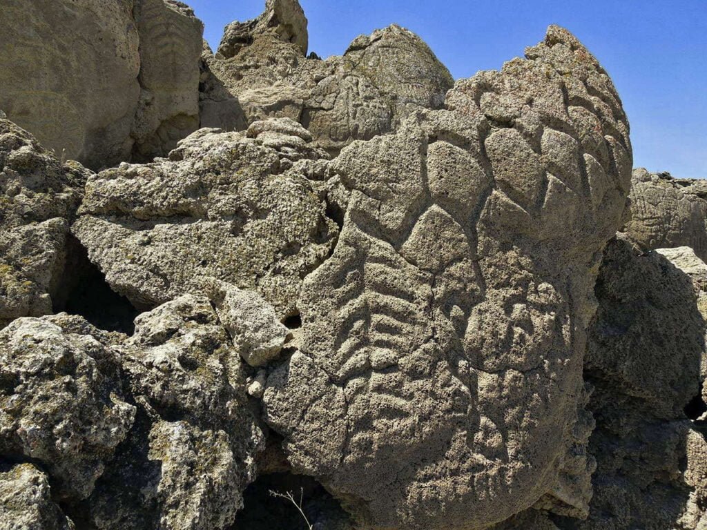
Ancient rock art carvings found at Lake Winnemucca
Lake Winnemucca Petroglyphs, Nevada
Located near Pyramid Lake in Nevada, the petroglyphs at Lake Winnemucca are among the oldest known rock carvings in North America, dating back more than 10,000 years.
The carvings, which include intricate geometric designs and abstract shapes, are believed to have been created by the early inhabitants of the Great Basin region. Some researchers think these petroglyphs had spiritual, cultural, communicative or ritualistic significance to the early peoples.
The ancient creators of Winnemucca petroglyphs
The identity of the petroglyphs’ creators is not definitively known. The best estimation is that the cravings are the works of the ancestors of the Northern Paiute or other prehistoric indigenous peoples that inhabited the region thousands of years ago.
The petroglyphs at Lake Winnemucca consist mainly of abstract geometric patterns, spirals, and grid-like designs. Some feature intricate line work that suggests a deep understanding of symmetry and design.
Unlike many other petroglyph sites that depict animals or human figures, the Lake Winnemucca petroglyphs are more focused on abstract and symbolic representations, adding to their enigmatic nature.
Radiocarbon dating of the stone’s carbonate crust – that formed over the petroglyphs over time – suggests that they are somewhere between 10,500 and 14,800 years old. This makes the Lake Winnemucca rock carvings some of oldest rock art in North America. This mind-boggling age adds significance to the importance of these carvings.
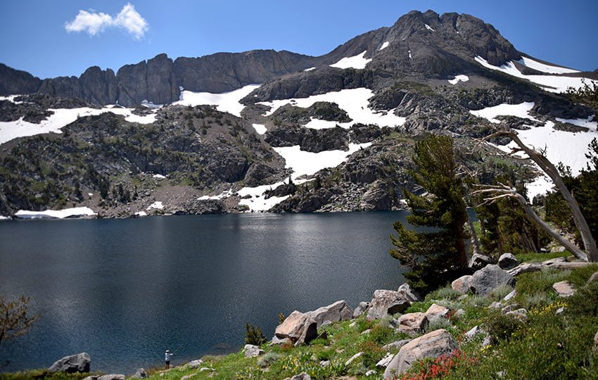
Cultural Significance of Lake Winnemucca
To the indigenous peoples of the Great Basin, including the Northern Paiute, sites like Lake Winnemucca hold profound cultural and spiritual signficance.
Interpretations of the petroglyphs vary even among local tribes, but the carvings are often viewed as sacred symbols or communications left by their ancestors. The abstract nature of the petroglyphs spur varying interpretations – everything from dreams and hallucinations to extraterrestrial visitations and spirits.
Whatever the inspiration behind the carvings at Lake Winnemucca, it is clear that the site held great importance to those who created them.
Today, the Lake Winnemucca petroglyphs are protected as part of the Pyramid Lake Indian Reservation. The preservation of these ancient carvings is paramount because they represent an irreplaceable link to the area’s prehistoric inhabitants.
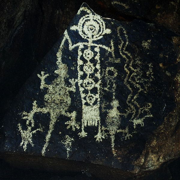
Figures carved into rock in the Mojave Desert’s Coso Range have mystified locals and explorers for decades
Coso Range Petroglyphs, California
The rock art panels of the Coso Range in the Mojave Desert, California are one of the most significant and extensive rock art sites in North America, called the Coso Rock Art District.
Carved into volcanic rock surfaces of the region, thousands of Coso Range petroglyphs depict hunting scenes, animals, abstract patterns, and shamanistic beings.
These petroglyphs were created by Native American groups, possibly the ancestors of the Paiute and Shoshone tribes, between 1,000 and 3,000 years ago. The carvings were made by pecking, incising, or abrading the rock using stone tools.
What do the Coso rock etchings showcase?
The Coso Range petroglyphs primarily depict intricate scenes of hunting, with images of bighorn sheep, deer, and other wildlife.
They also feature abstract patterns, anthropomorphic figures, and representations of shamanistic or spiritual beings created by the Native American groups of the Great Basin.
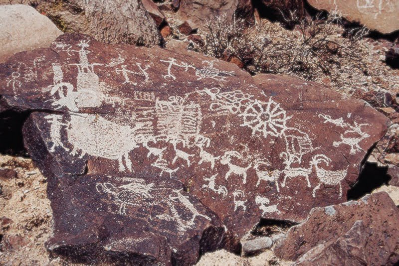
The petroglyphs were carved into volcanic rock using stone tools, a process that involved pecking and incising the rock surface to create intricate artworks.
The stone materials and techniques employed have allowed the Coso Range petroglyphs to endure for thousands of years, offering a glimpse into their lives and beliefs. The Coso Rock Art District spans some 90 square miles across several large canyons and rock formations dotted with thousands of petroglyphs.
Planning a visit to the Coso Range
To visit the Coso Range pictographs, located on the Naval Air Weapons Station at China Lake in California, you will need to obtain special permission beforehand as the site is on a restricted military base.
Guided tours are typically arranged through the Maturango Museum in Ridgecrest. The tours usually involve driving to the site with a guide and then hiking to see the petroglyphs.
The hike itself is about four miles roundtrip and involves moderate terrain. The elevation at the Coso Range varies but generally averages between 4,000 to 5,000 feet above sea level. The terrain is rocky and rugged. Hikers with experience are most suited for this trip.
It is essential to plan ahead and check the requirements for access, as the site is not freely accessible to the public.

This fabulous centuries-old rock art scene is referred to as ‘The Great Hunt’ created by the Fremont people sometime between 950 and 1250 CE
Nine-Mile Petroglyphs, Utah
Often called ‘the world’s longest art gallery,” with thousands of petroglyphs depicting daily life and spiritual beliefs, the rock art found in Utah’s Nine-Mile Canyon region are stunning.
This unique and beautiful area is home to one of the most extensive collections of petroglyphs in North America.
Located near the towns of Price and Wellington, the canyon’s elaborate outdoor gallery stretches for nearly 40 miles and contains thousands of petroglyphs, offering a glimpse into the lives of the ancient Fremont culture, who inhabited the area between 950 and 1250 CE.
What do the Nine-Mile petroglyphs depict?
The petroglyphs in Nine-Mile Canyon depict a variety of scenes, including detailed images of bighorn sheep, hunters, and other wildlife. Human figures, often shown with bows and arrows, are also common, as are depictions of spiritual symbols and abstract patterns.
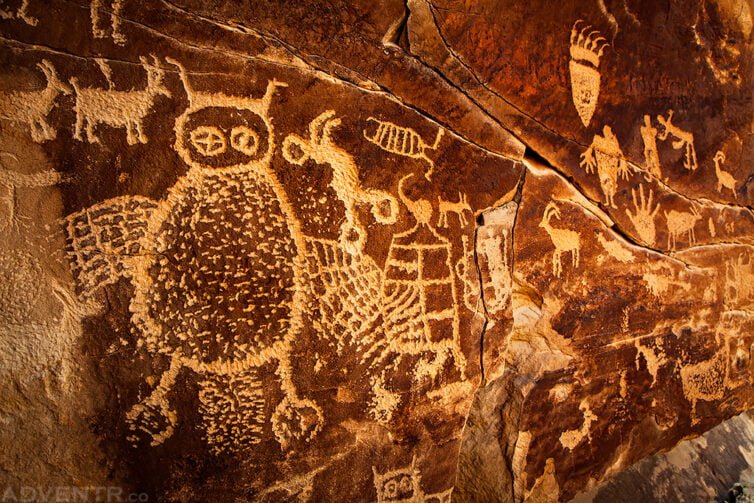
Intricate ancient drawings of an owl and other animals, plus strange figures and symbols, at Nine-Mile Canyon
One of the most famous panels is called ‘The Great Hunt,’ which portrays an active hunting scene featuring numerous bighorn sheep and hunters.
The Fremont people, who lived in the region over a millennium ago, used stone tools to peck and carve the artworks into the canyon’s rock surfaces. The petroglyphs served as more than just decorative; they likely had cultural and spiritual significance, relaying stories of daily life, hunting rituals, and possibly religious and spiritual beliefs.
Planning a trip to Nine-Mile Canyon
To visit Nine Mile Canyon, drive from Price, Utah, heading east on US-6 for about 20 miles.
Turn onto Nine Mile Canyon Road. The petroglyphs are accessible directly from the road, with several marked pullouts for easy viewing. No extensive hiking is required. It’s safe to assume you’ll need the bulk of a day to explore the canyon.
Nine Mile Canyon offers a unique opportunity to connect with ancient history through its stunning collection of petroglyphs. As with so many areas of Utah, the surroundings are beautiful and peaceful.
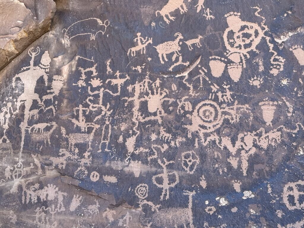
The busy Newspaper Rock petroglyph panel near Monticello, Utah
Newspaper Rock Petroglyphs, Utah
Newspaper Rock, located in southeastern Utah, is one of the largest and most accessible petroglyph panels in the state.
The blackened rock face is covered with hundreds of carved symbols, figures, and designs created by various Native American cultures over the course of 2,000 years.
The petroglyphs include depictions of animals, human figures, and a variety of mysterious symbols.
Newspaper Rock is a well-preserved record of ancient communication, with petroglyphs from several different cultures, including the Anasazi, Fremont, and Navajo.
The sheer number and variety of symbols on Newspaper Rock make it a unique and invaluable site for understanding the region’s ancient inhabitants. Because of all of the scenes recorded from history on the rock panel, and due to the number of differing contributors, locals called it ‘newspaper rock.’
Experiencing the rock art and getting there
These petroglyph sites provide an extraordinary window into the lives and spiritual beliefs of ancient Native American cultures. As you explore these sites, you’ll not only witness the artistic expression of early peoples but also connect with the deep history embedded in the landscapes of the American Southwest.
Whether you’re a history enthusiast, a nature lover, or simply curious, these petroglyphs offer an experience that is both educational and profoundly moving.
To get to the site from the nearby town of Monticello, start out by heading north on US-191 for about 14 miles. Next, turn left onto UT-211 W and drive for 12 miles. This is the road leading to the Needles District of Canyonlands National Park. Follow the signs to the designated parking area. The drive takes about 45 minutes from Monticello.
Visitors to the site are encouraged to respect the petroglyphs and the land, ensuring that this invaluable cultural heritage is preserved for future generations.
For more information on Newspaper Rock, go to the Utah State Historical Society webpage.
Valley of Fire Petroglyphs, Nevada
The Valley of Fire State Park, located approximately 35 miles east of Las Vegas, is renowned for its stunning red sandstone, strange geological formations and ancient petroglyphs.
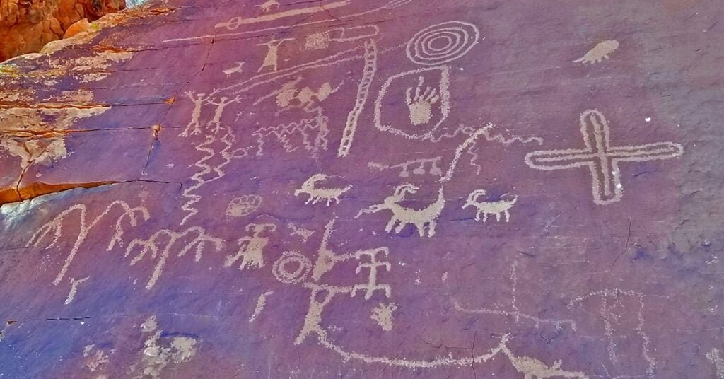
The Valley of Fire petroglyphs were created by the Ancestral Puebloans (also known as the Anasazi) and date back approximately 3,000 years. The petroglyphs scattered throughout the park depict a variety of subjects, including animals, human figures, and abstract symbols.
One of the best collections of petroglyphs in the Valley of Fire are found at Atlatl Rock. The panel showcases hunting activities and tools. Most of the petroglyphs are well-preserved, offering ancient insights into the culture and beliefs of the Ancestral Puebloans.
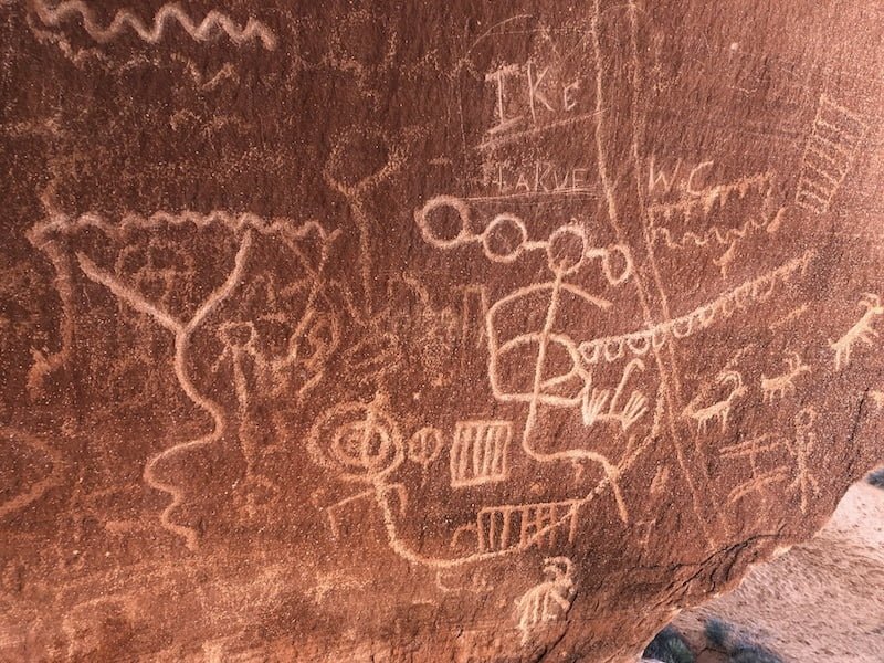
Mysterious petroglyph panels are found throughout Valley of Fire State Park
Located in a small canyon near the park’s entrance, the location known as Mouse’s Tank contains numerous petroglyphs, depicting a variety of abstract symbols, animals, and human figures. This area is easily accessible via a short hike from the park’s main road.
Don’t miss Petroglyph Canyon. This area houses a large collection of petroglyphs with panels that include spirals, geometric patterns, and representations of daily life. The trail through Petroglyph Canyon offers a close-up view of these ancient carvings.
Each site in the park showcases the skill and mysterious nature of the Anasazi’s creativity who used the natural rock surfaces as canvases to record their stories. Exploring these petroglyphs provides a direct connection to the past, allowing visitors to experience the rich cultural heritage of the area.
Learn more about Valley of Fire State Park, include the relatively easy driving directions from Las Vegas, via the official state website.
“730”



Recent Comments